Purig is the historical name of the Kargil region. Most of its people are Shia Muslims who speak Purgi, a Tibetic language closely related to Balti and Ladakhi.
Source: Kargil
Himalaya only · Saver trips from ₹7,500
Try "Spiti", "snow leopard", "Char Dham", "homestay", "Tiger's Nest"
Town in Ladakh
Purig's river town between Zoji La and Leh
Kargil is Ladakh's second town, at 2,676 m on the Suru river, roughly halfway between Srinagar and Leh. Most people of the region are Shia Muslims who speak Purgi. Sleep here on the road trip from Srinagar, and use it as the start of the Suru valley road to Zanskar.
 Photo: Saurabh Lall · CC BY 2.0 · Commons
Kargil is where most road travellers from Srinagar spend their first night in Ladakh, and most of them leave at dawn without looking around. That is a pity. The town sits in a bowl where the Suru river runs between bare brown slopes, with poplar and willow along the water and apricot orchards climbing the side valleys. The main bazaar sells dried apricots, copper and everyday goods to villages up and down the valley.
The old name for this country is Purig, and its people and language are still called Purgi. Most are Shia Muslims, and the mosques, the black flags of Muharram and the imambaras make Kargil feel quite different from Buddhist Leh. A few hours east, though, Mulbekh and Shergol are Buddhist villages with gompas on the cliffs, and the change between the two worlds happens over a few kilometres of road.
For planning, Kargil matters for two reasons. At 2,676 m it is a gentle first night for anyone driving from Srinagar over Zoji La, much kinder to the body than flying straight into Leh. And it is the gateway to the Suru valley, Rangdum, Pensi La and Zanskar, a long day's drive south past the white faces of Nun and Kun.
Forty kilometres east, a standing Maitreya about 9 m tall is carved into a rock pillar beside the highway at Mulbekh, with a small shrine built against it. Above the village, the Mulbekh gompa clings to a cliff. Stop for twenty minutes on the way to Lamayuru.
Walk the main bazaar in the morning for dried apricots, apricot kernels and local copperware. In July and August fresh fruit arrives from the side valleys. Prices are lower than in Leh, and shopkeepers will tell you which village the fruit came from.
South of Kargil, the road follows the Suru river through Sankoo and Panikhar, with views of the Nun and Kun massif, both above 7,000 m. Even a half-day drive to Panikhar shows a greener, wetter Ladakh.
Sixty kilometres west on the Srinagar road, Drass is often called one of the coldest inhabited places in Asia. The war memorial outside town honours soldiers who died in 1999, and most road travellers stop for a short visit.
Just east of Mulbekh, Shergol has a tiny white gompa set into a cliff face high above the Wakha river. It is a short, steep walk up from the road, best in morning light.
Coming from Srinagar, Kargil at 2,676 m is lower than Leh by more than 800 m. Sleeping here, then at Lamayuru or Alchi, is the easiest way to arrive in Ladakh without headaches.
Field notes
Purig is the historical name of the Kargil region. Most of its people are Shia Muslims who speak Purgi, a Tibetic language closely related to Balti and Ladakhi.
Source: Kargil
The Mulbekh Chamba is a standing image of Maitreya, the future Buddha, about 9 m tall and carved in relief on a rock beside the Srinagar–Leh highway east of Kargil.
Source: Mulbekh Monastery
Drass, on the Srinagar road west of Kargil, sits at about 3,280 m and is often described as one of the coldest inhabited places in the world, with winter lows far below −20 °C.
Source: Dras
Experiences
 Photo: Jparande · CC BY-SA 3.0 · Commons
Drive east from Kargil into Buddhist Purig to see the 9 m rock-cut Maitreya at Mulbekh, the cliff-top Mulbekh gompa and…
 Photo: Narender9 · CC BY-SA 4.0 · Commons
Follow the Suru river south from Kargil past Sankoo to Panikhar, where meadows and willow groves face the snow and ice …
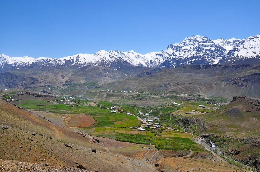 Photo: Narender9 · CC BY-SA 3.0 · Commons
Drass, 60 km west of Kargil, is a high village known for hard winters. The war memorial beside the road remembers soldi…
Real prices
Local prices change with season and fuel costs. Check current status before you travel.
Getting there
Air
Most travellers fly to Leh or Srinagar and drive. Kargil's airstrip sees only occasional civil flights; check current status before you travel.
Bus
JKSRTC and Ladakh buses link Kargil with Leh and Srinagar in season, usually leaving early in the morning. Shared Sumo taxis also run from Srinagar and Leh. Timings and fares change; check current status before you travel.
Road
From Srinagar ≈ 204 km · 6–7 h via Sonamarg, Zoji La and Drass. From Leh ≈ 220 km · 6–7 h via Lamayuru, Fotu La and Mulbekh. Zoji La usually opens in spring and closes with heavy snow in winter.
Where to stay
Saver: the bazaar area has many simple hotels and guesthouses at ₹1,500–3,000 a double, popular with truckers and bus travellers. Comfort: a few established hotels along the Suru river and the main road offer heated rooms, attached bathrooms and restaurants at ₹3,500–7,000 a double. Signature: there is no luxury hotel in Kargil; we choose the best available hotel for one night and keep the money for the Nimmu or Leh end of the trip.
Trips that stop here
 Photo: Anirvan Shukla · CC BY-SA 3.0 · Commons
Comfort
Photo: Anirvan Shukla · CC BY-SA 3.0 · Commons
Comfort
Private SUV with driver; local car in Padum where required
Photo: Saurabh Lall · CC BY 2.0 · Commons
Saver
Shared Sumo taxis, state buses and local shared cars
Questions
Most travellers use Kargil as a night halt between Srinagar and Leh, but it rewards an extra half day. Walk the bazaar for apricots, drive to Mulbekh's rock-cut Maitreya, or follow the Suru valley towards Nun Kun. If you are heading to Zanskar, Kargil is the natural base.
Kargil is about 220 km from Leh, 6–7 hours via Lamayuru and Fotu La, and about 204 km from Srinagar, 6–7 hours via Zoji La and Drass. Buses and shared taxis run both ways in season, usually leaving early in the morning.
Yes. Kargil is a working town that sees many travellers on the Srinagar–Leh road. It is conservative, so dress modestly, keep public behaviour low-key and ask before photographing people. During Muharram there are large religious processions; travel around them respectfully.
No permit is needed for Kargil town, Drass, Mulbekh, the Suru valley or Zanskar. Carry photo ID for routine checkposts. Some areas near the Line of Control are restricted; follow army instructions. Rules change, so check current status before you travel.
Kargil town is about 2,676 m, much lower than Leh. That makes it the gentlest first night for anyone driving into Ladakh from Srinagar. Drass, west of town, is higher at about 3,280 m, and Fotu La on the way to Leh reaches 4,108 m.
Zoji La, between Sonamarg and Drass, usually opens to traffic in spring and closes after heavy snow in winter, with exact dates set by road authorities each year. A tunnel is under construction. Check current status before you travel and leave early, as the pass can be one-way at times.
Yes. Kargil has several bank ATMs in the main bazaar. Postpaid connections from major networks work in town; prepaid SIMs from outside Jammu and Kashmir and Ladakh usually do not. Coverage fades quickly in the Suru valley and towards Zanskar.
Try local bread from the bazaar bakeries, mutton dishes and apricot in every form: dried fruit, kernels and the apricot-kernel oil used in cooking. Many hotels serve Kashmiri and north Indian food. Kargil is mostly a non-alcoholic town, so do not expect bars.
It is possible but very long: Kargil to Padum is about 235 km over Pensi La, 10–12 hours of rough driving. We prefer breaking the journey at Rangdum, about 130 km from Kargil, especially for families and older travellers. Check road status before you travel.
Plan with a local planner
We reply within one working day with a route, a sleeping-altitude profile and an itemised price in your tier. Change anything. Pay nothing until you are sure.