Nature · Trongsa, Bhutan
Over Pele La, west to central Bhutan
The drive from Phobjikha to Trongsa crosses Pele La at 3,420 m, the boundary between western and central Bhutan, through dwarf bamboo, yak pastures and fir forest, with Jomolhari on clear mornings.
 Photo: Christopher J. Fynn · CC BY-SA 4.0 · Commons
From the Phobjikha turn-off the Lateral Road climbs east to Pele La at 3,420 m. The pass is traditionally the line between western and central Bhutan. On clear days you can see Jomolhari (7,326 m), Jichu Drake (6,662 m) and Kang Bum (6,526 m). Prayer flags snap in the wind, and local artisans sell textiles and handicrafts at the top.
The country here is high and wild: dwarf bamboo, fir, rhododendron and herders' camps where yaks graze in summer. Below the pass on the east side, look for small villages such as Rukubji, with its square of fields, and Chendebji with its white chorten. Bhutan's Trans Bhutan Trail, a restored old walking route, crosses this area.
The road is narrow in places, with roadworks and occasional landslides in the monsoon and snow from December to February. Your driver will know the day's conditions; check current status before you travel. Take travel-sickness tablets if you need them, and carry a warm layer for the pass.
Good for
Also in Trongsa
More days here
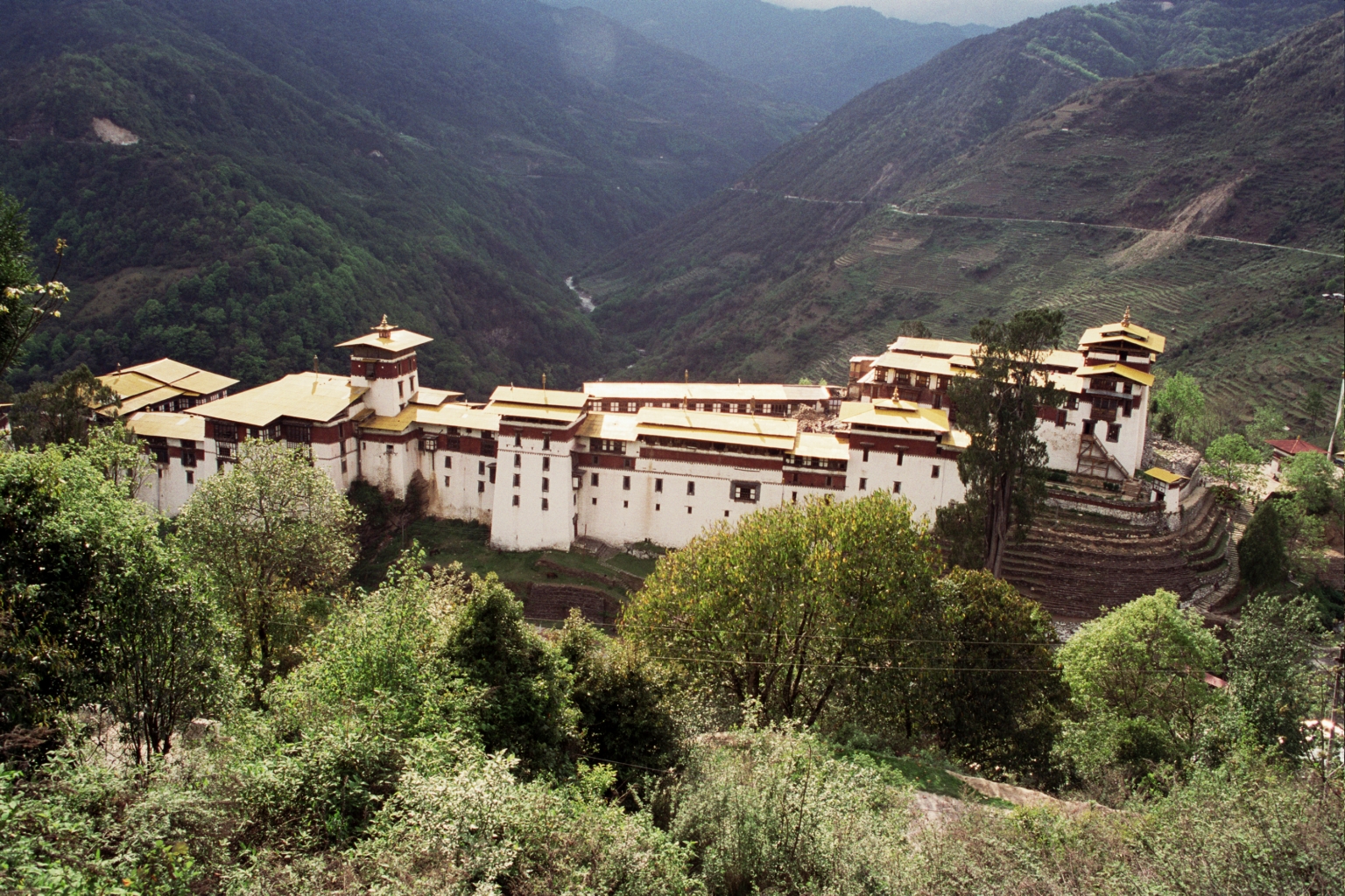 Photo: Unknown author · CC BY-SA 3.0 · Commons
Trongsa Dzong and the Ta Dzong museum
Start in the round watchtower museum above town for the story of the Wangchuck penlops, then walk down to the dzong's t…
 Photo: Stephen Shephard · CC BY-SA 3.0 · Commons
Tea stop at Chendebji Chorten
Break the drive between Pele La and Trongsa at an 18th-century white stupa built in the style of Kathmandu's Boudhanath…
Trips through Trongsa
Do this on a trip
Each of these trips stops in Trongsa. Tell us and we keep a slot for this day.
 Photo: Christopher J. Fynn · CC BY-SA 3.0 · Commons
Comfort
Photo: Christopher J. Fynn · CC BY-SA 3.0 · Commons
Comfort
Central Bhutan to Bumthang, 12 nights
Private car with driver
Questions
Before you book
How high is Pele La?
About 3,420 m. Most people pass through without trouble after nights in Phobjikha at 3,000 m. Stop for 10–15 minutes, walk slowly and drink water.
Is the road over Pele La safe?
It is a narrow mountain road with steep drops, roadworks and occasional landslides, but drivers in Bhutan are experienced on it. Snow can close it briefly in winter. Check current status before you travel.
Can I see yaks on Pele La?
Sometimes, mostly in the cooler months when herders bring animals lower. In summer they graze higher up. Ask before photographing herders or their camps.